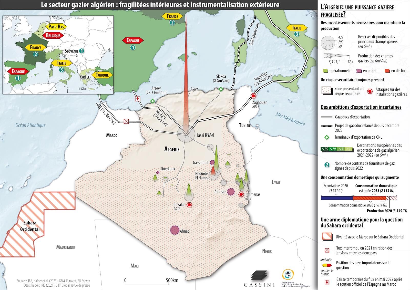
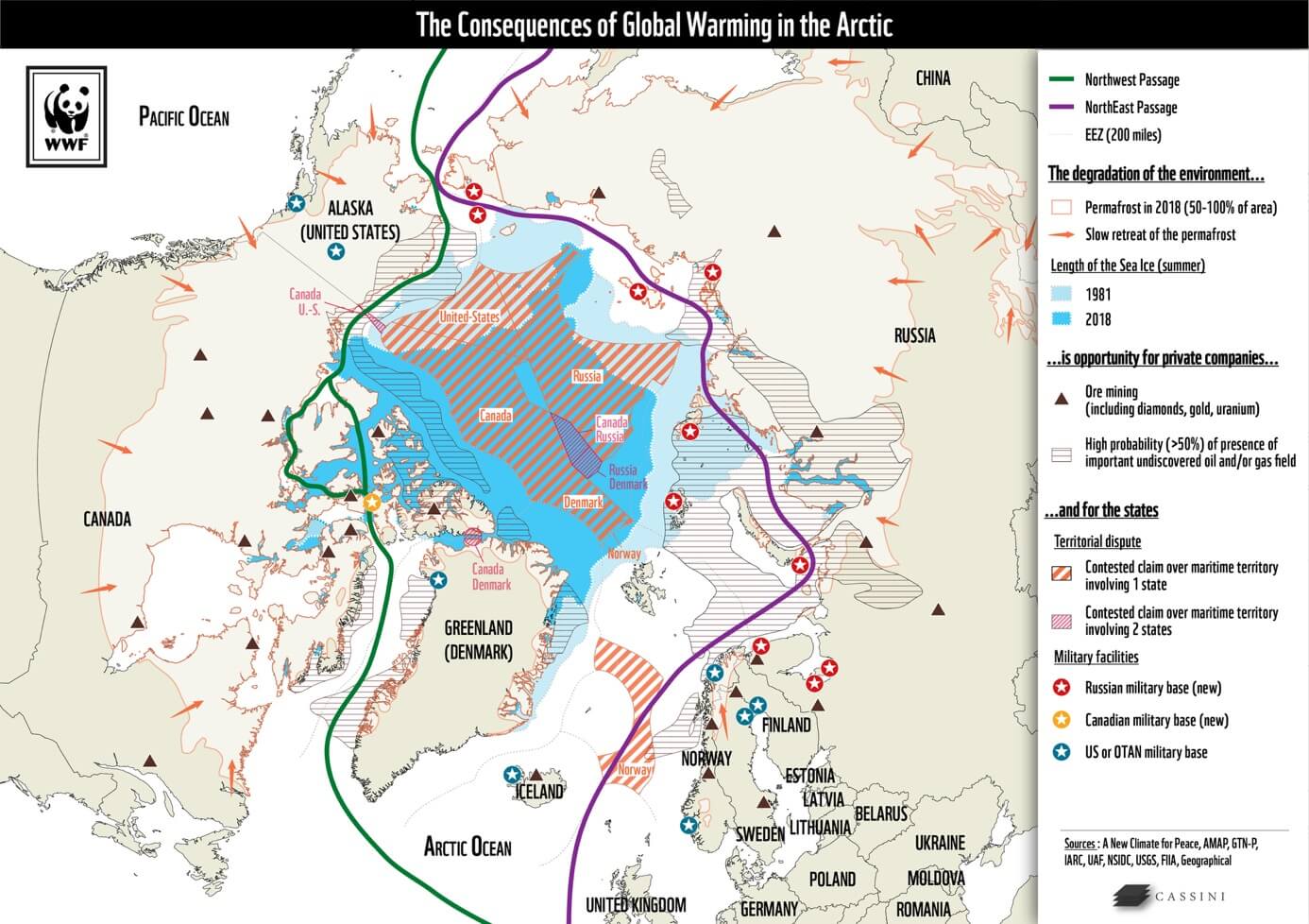
01
01
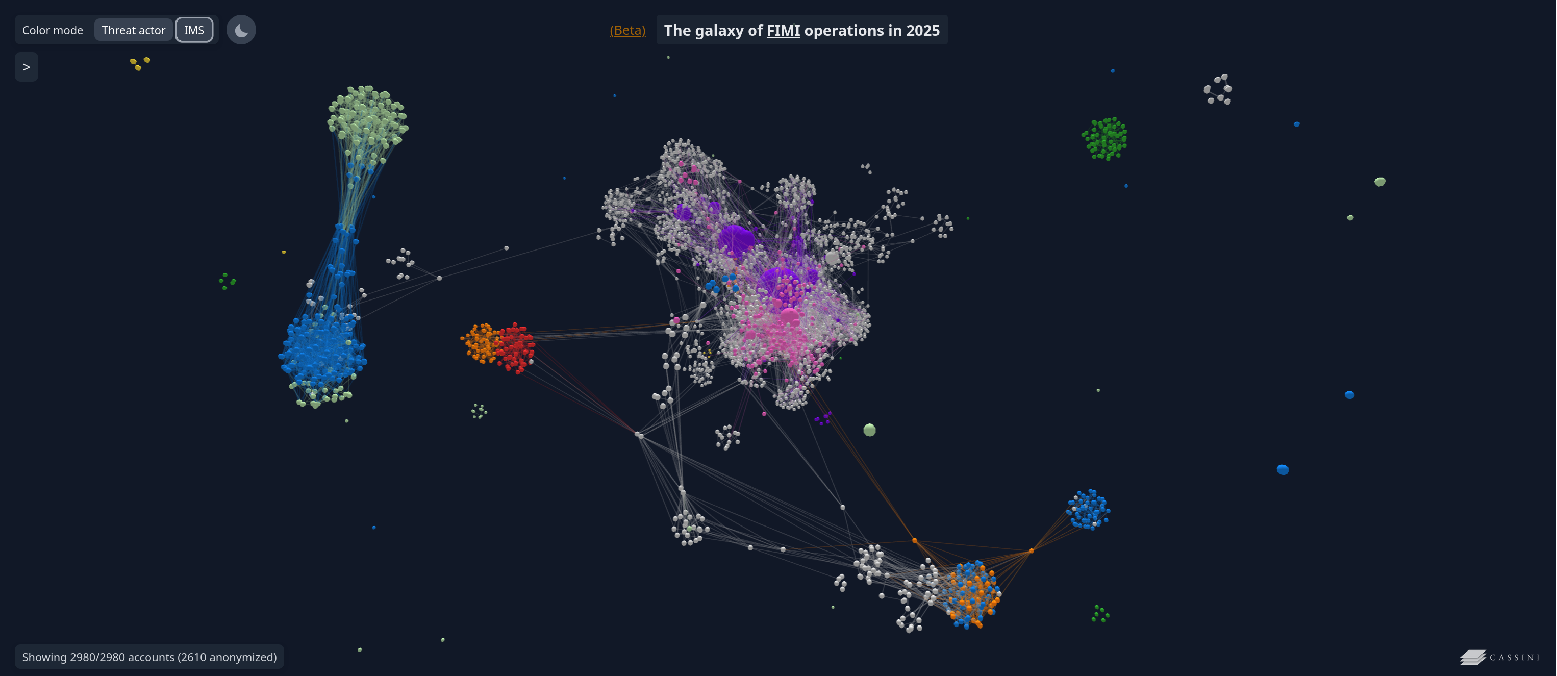
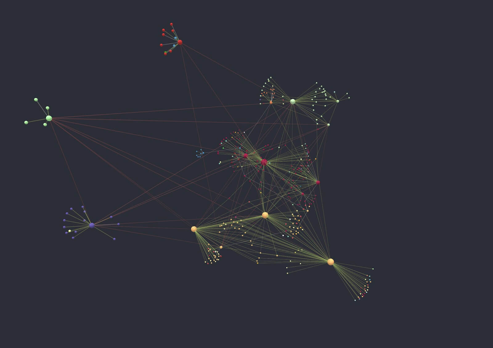
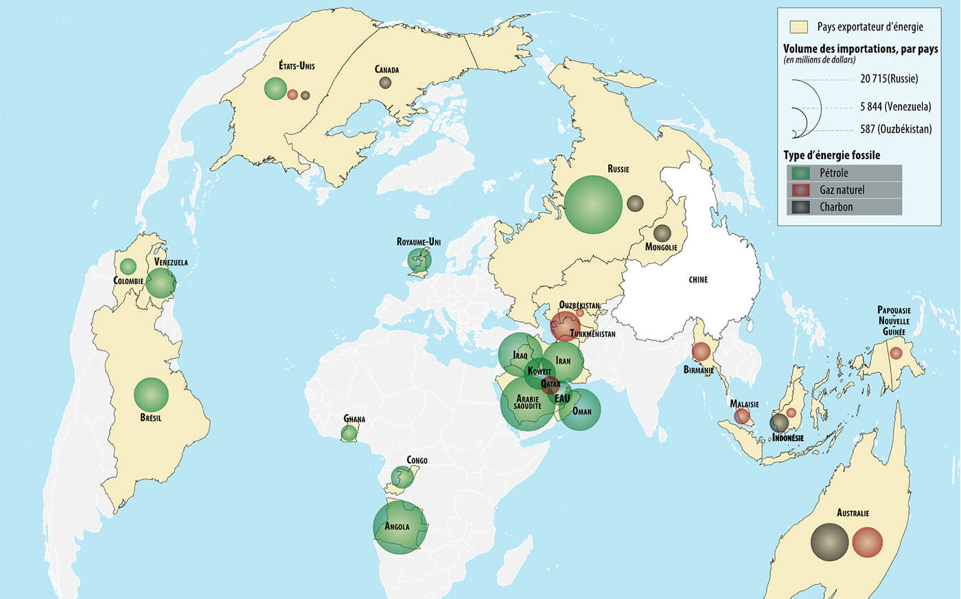
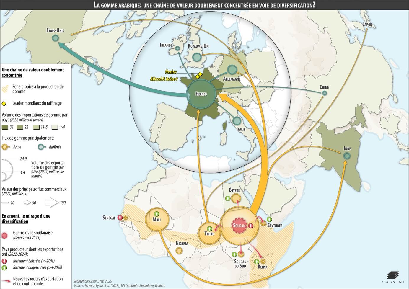
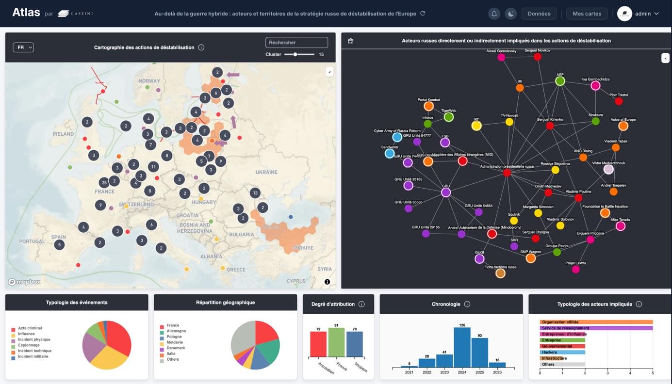
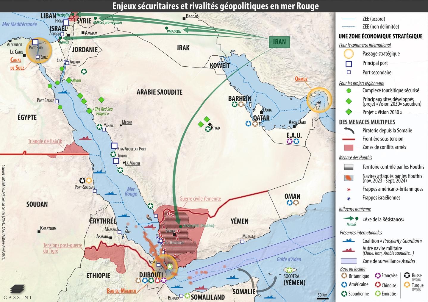
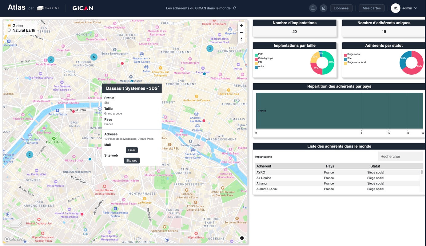
Geopolitical mapping
CASSINI designs geopolitical maps that problematize spatial data to produce structured and impactful analyses. Serving as both a decision-making tool and a communication medium, these maps make your messages and analyses immediately understandable.