This website requires JavaScript.
Geopolitical mapping

Climate Change and Geopolitical Crises

Summary

As part of an international awareness campaign, the NGO WWF sought to demonstrate to decision-makers of major powers that climate change constitutes a major aggravating factor in contemporary geopolitical crises.

CASSINI was brought in to design a series of educational and strategic maps illustrating, through specific case studies, the correlation between climate disruptions and political destabilisation.

Issue

While climate change is widely addressed from an environmental and economic perspective, its geopolitical consequences remain less well known or underestimated in national policies.

WWF's objective was therefore to offer a new perspective: to show that climate acts as a threat multiplier, capable of exacerbating social fragilities, triggering migrations, reinforcing territorial tensions and, in some cases, contributing to the emergence of armed conflicts.

The challenge was to make an immediately readable account of a complex, multidimensional and often debated phenomenon.

Cartographic Solution

CASSINI designed a series of thematic maps, each centred on an emblematic territory where the climate factor contributed to a crisis dynamic.

Among the cases studied:

  • The Syrian Civil War: the map highlighted the decade of exceptional drought that affected the east of the country (2000–2010), causing the impoverishment of rural populations and a massive internal exodus towards urban centres. All of this contributed to the destabilisation that preceded the outbreak of the 2011 crisis.
  • Arctic Competition: the aim was to show that the accelerated melting of ice and the gradual opening of new maritime routes has reignited strategic competition among bordering powers for control of resources and commercial corridors.
  • Climate Migration in the Indian Ocean: rising sea levels highlight the vulnerability of threatened island states, raising questions about climate migration and territorial sovereignty.
  • Worsening of the Darfur Crisis: the reduction of arable land linked to worsening drought has driven the concentration of populations into restricted areas, intensifying rivalries over access to resources.
  • Piracy in Somalia: the dumping of pollutants off the Somali coast and industrial fishing by foreign fleets impoverished the artisanal fishing sector. Part of the local population thus turned to opportunistic piracy in one of the world's most strategically important shipping lanes.

Each map connects climate data, demographic dynamics and political factors in order to make visible the link between global warming and conflict.

Impact

The deliberately clear and concise cartographic format made the geopolitical dimension of climate change immediately perceptible.

By materialising the interactions between environmental stress and territorial destabilisation, the maps helped to establish a strategic reading of climate among international decision-makers.

Presented in a high-level setting, they reinforced the reach of WWF's message and fostered an awareness of the structuring role of climate in the balance of power.

This project illustrates CASSINI's ability to transform complex data into strategic visual materials, capable of shaping public debate and influencing political agendas.

Previous case study

Risk assessment & geopolitics
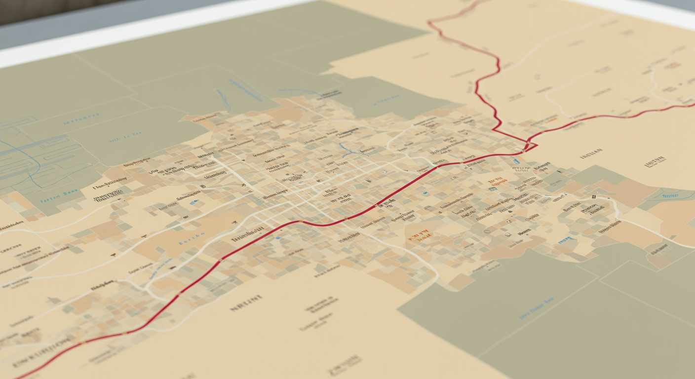
Territorial Analysis and Strategic Support in the Construction of the Jerusalem Tramway
As part of its participation in a Franco-Israeli consortium responsible for building a tramway in Jerusalem, Veolia faced international contestation. CASSINI produced a geopolitical analysis and detailed maps to inform the judicial debate.

Next case study

Geopolitical mapping
Observatory for the Security of Energy Flows and Raw Materials (OSFME)
Since 2019, CASSINI has contributed to the Observatory for the Security of Energy Flows and Raw Materials (OSFME) on behalf of the DGRIS of the Ministry of Armed Forces, in order to analyse the energy strategies of major powers and strengthen France's strategic anticipation capacity.