Geopolitical mapping
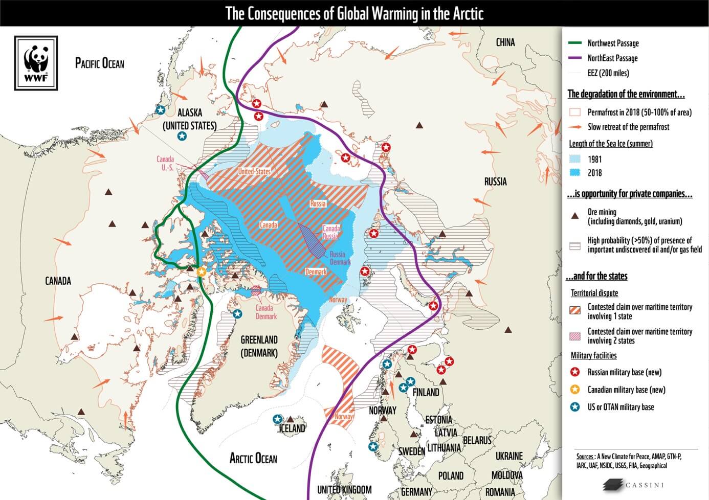
Climate Change and Geopolitical Crises
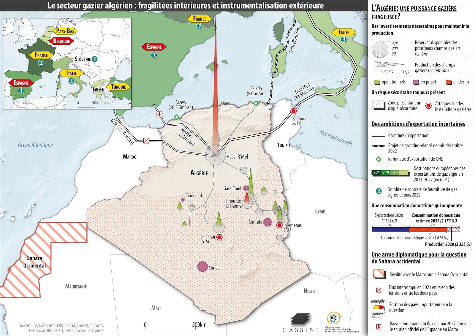
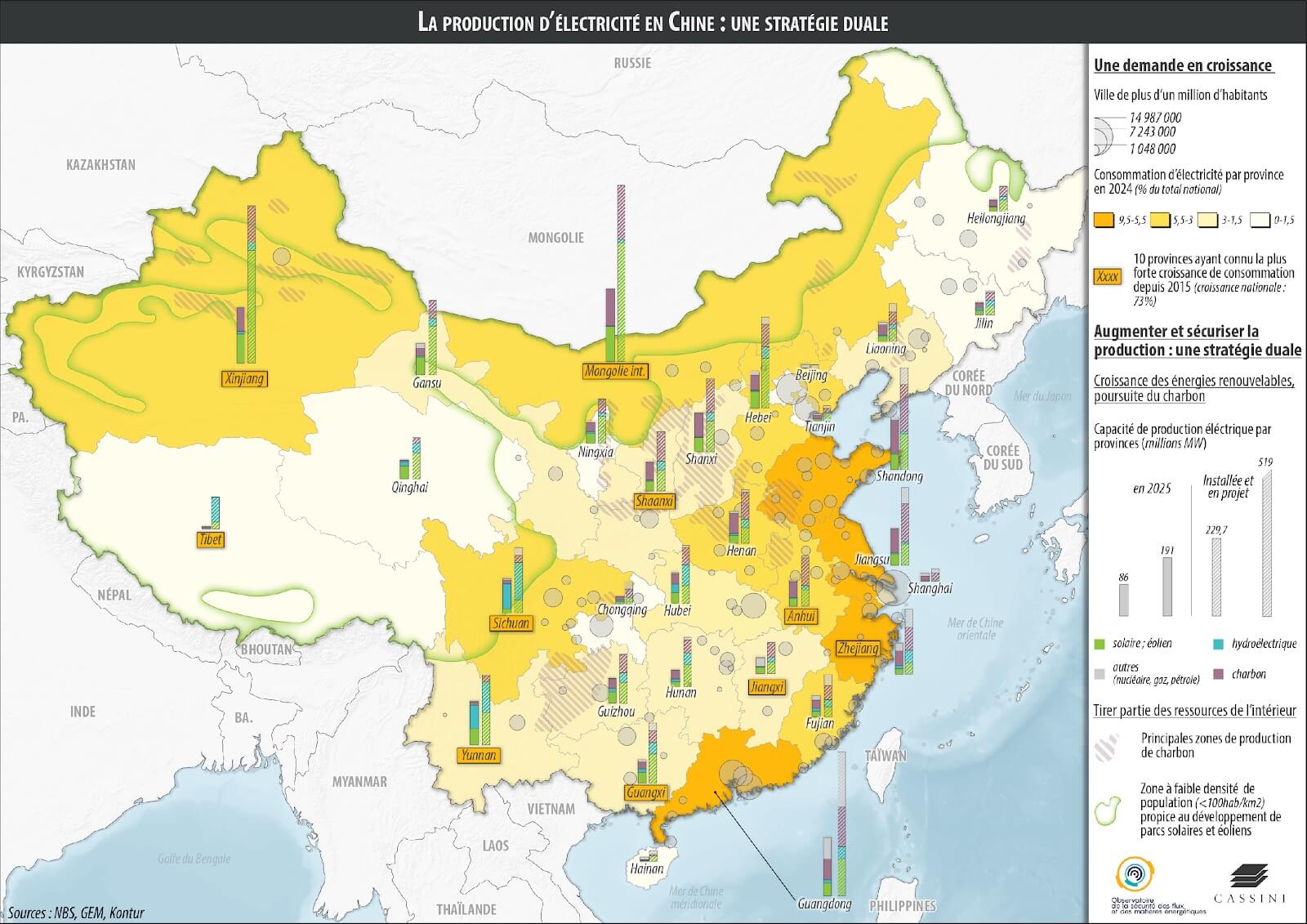
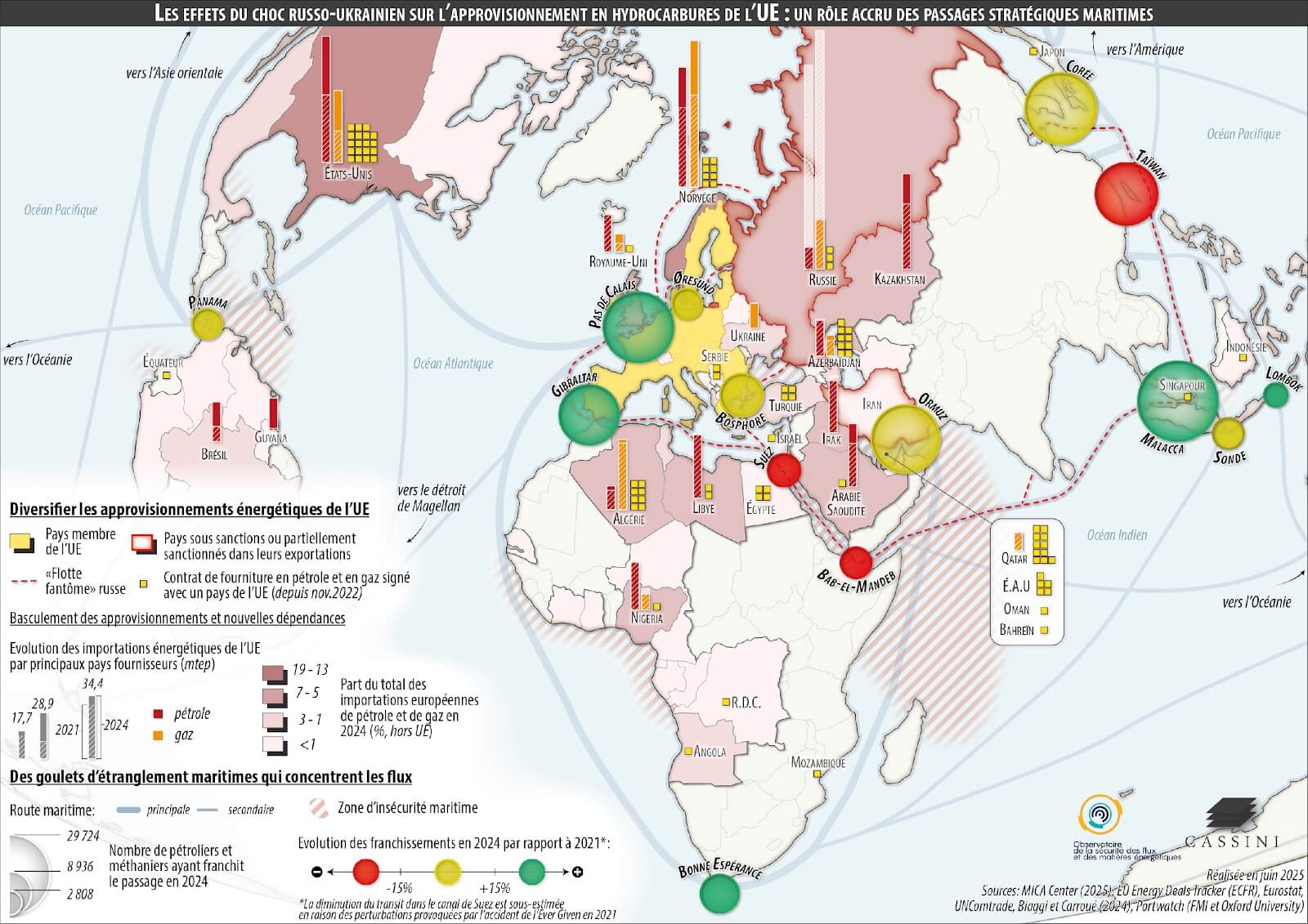
As part of an international awareness campaign, the NGO WWF sought to demonstrate to decision-makers of major powers that climate change constitutes a major aggravating factor in contemporary geopolitical crises. CASSINI designed a series of educational and strategic maps illustrating the correlation between climate disruptions and political destabilisation.