This website requires JavaScript.
Risk & geopolitical analysis

Territorial Analysis and Strategic Support in the Construction of the Jerusalem Tramway

Summary

As part of its participation in a Franco-Israeli consortium responsible for building a tramway in Jerusalem, the French group Veolia faced international contestation regarding the route of the project through East Jerusalem, a territory annexed by Israel in 1967 whose status is not recognised under international law.

CASSINI was engaged to decode the geopolitical, territorial and legal complexity of the situation, and to produce a structured analysis supported by detailed cartography intended to inform the judicial debate.

Issue

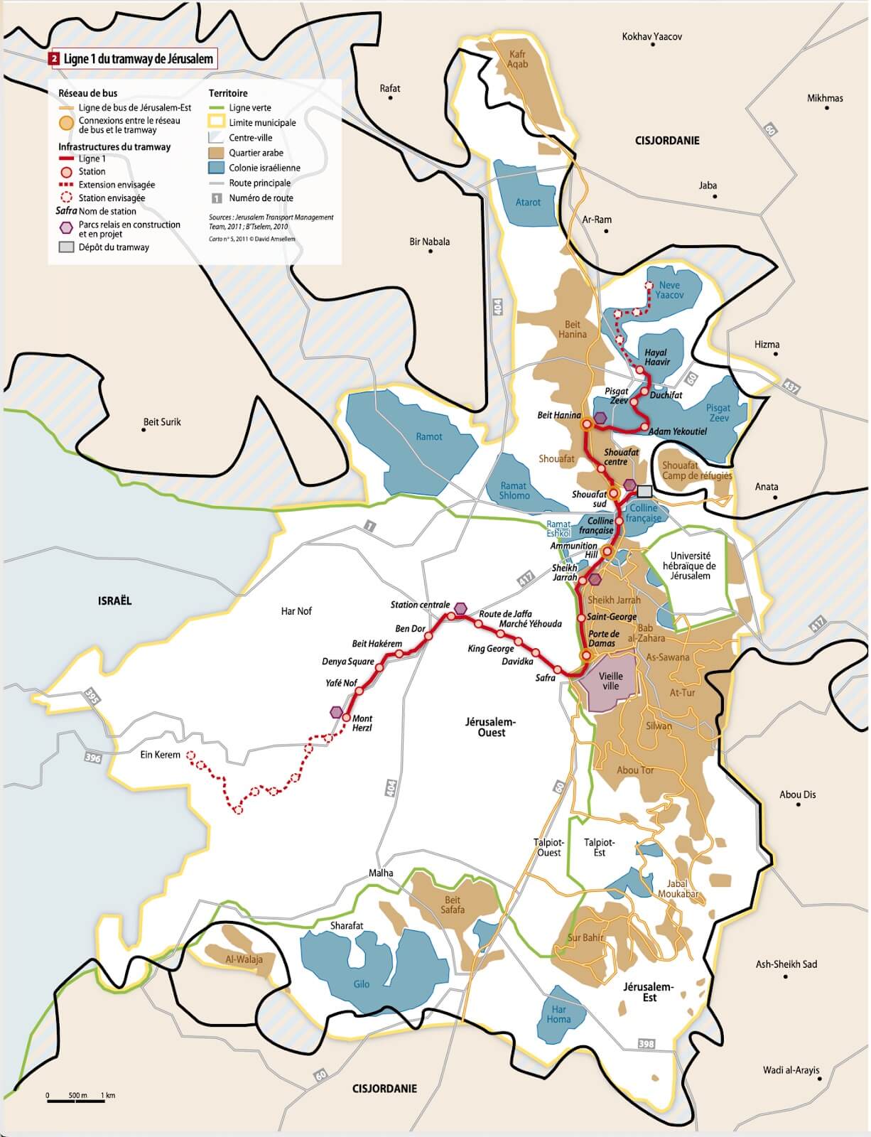
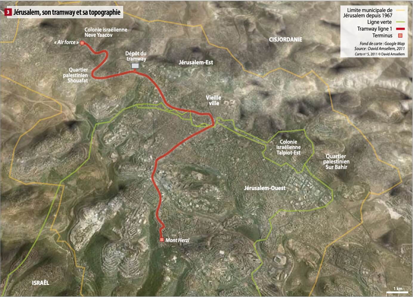
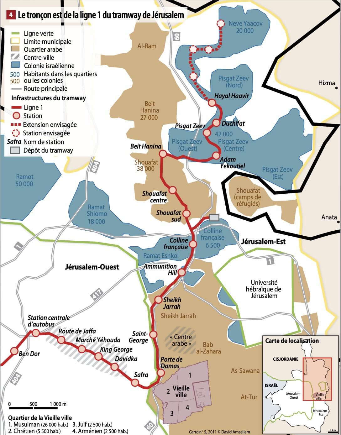
The tramway route crossed a city whose status is one of the most sensitive geopolitical issues. Jerusalem concentrates official and unofficial borders, armistice lines, administrative divisions, neighbourhoods with differentiated legal statuses, as well as an overlapping of political, religious and symbolic territories. Part of the route planned by the municipality crossed East Jerusalem, a territory occupied by Israel according to UN resolutions.

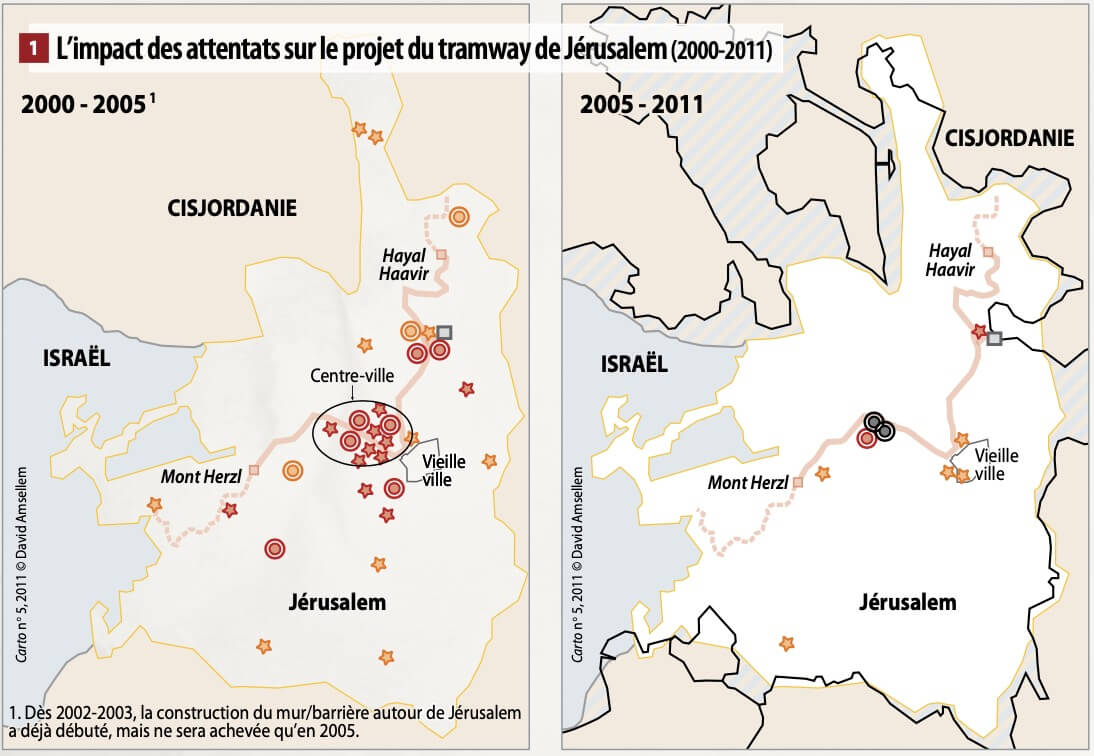
In this context, several organisations initiated legal proceedings against Veolia, arguing that its participation in the project contributed to consolidating an occupation deemed illegal.

The challenge for the company was twofold: to precisely understand the territorial complexity of the project and to have a rigorous analysis enabling it to respond to arguments put forward on legal, political and media grounds.

Methodology

CASSINI conducted an in-depth geopolitical analysis of the city of Jerusalem by adopting a multi-layered reading of the territory. The study integrated:

  • the historical dynamics of the city's division and annexation;
  • successive administrative and municipal divisions;
  • demographic data and population distribution;
  • legal issues related to the status of the territories;
  • physical geography and topographic constraints influencing infrastructure routing.

This analysis was accompanied by the production of a set of problem-focused maps enabling visualisation of separation lines, urban continuities, settlements, circulation axes and planning logics. The objective was to clarify the concrete territorial realities and technical constraints that motivated the routing choices.

Strategic Contribution and Results

The analyses and maps produced were used in the context of legal proceedings initiated in France. They enabled French magistrates to grasp the territorial complexity of the project and to assess the routing choices against objective data: topography, urban density, neighbourhood continuity, and mobility needs.

In collaboration with Veolia's legal teams, CASSINI's geopolitical expertise contributed to structuring a solid argument, grounded in a thorough understanding of the territory and its statuses.

After several years of litigation, Veolia prevailed against the various plaintiff associations.

Impact

This mission illustrates CASSINI's capacity to intervene in highly sensitive contexts where territorial, legal and reputational issues intertwine.

By combining rigorous geopolitical analysis with strategic cartography, CASSINI transformed a complex political controversy into a structured and objectified argument, in service of defending the interests of an international economic actor.

This case demonstrates the operational value of in-depth territorial expertise in conflict-ridden environments, where understanding spaces and their statuses constitutes a decisive lever.

Étude de cas précédente

Anticipating Geopolitical Risks Affecting Maritime Routes in the Red Sea
Strategic foresight
Anticipating Geopolitical Risks Affecting Maritime Routes in the Red Sea
Following the attacks of 7 October 2023 and the extension of the conflict in the Middle East, a major maritime shipping operator engaged CASSINI to anticipate the evolution of tensions in the Red Sea and their consequences for its operations.

Étude de cas suivante

Prospective map of the Lake Chad region — geopolitical and climate scenarios for 2050 (Chad, Niger, Nigeria, Cameroon)
Strategic foresight
Geopolitical Scenarios around Lake Chad by 2050
As part of the preparation for a Conference of the Parties (COP), WWF commissioned CASSINI to conduct a prospective exercise on the geopolitical evolution of the Lake Chad region by 2050, based on four possible climate trajectories.