This website requires JavaScript.
Interactive Atlas

FIMI Explorer – Interactive visualisation of FIMI operations

Summary

The European External Action Service (EEAS), the diplomatic service of the European Union, required a tool to consolidate, visualise and leverage a large database collected as part of its monitoring activities on foreign information manipulation and interference (FIMI).

CASSINI deployed its Atlas interactive mapping platform to transform a complex and extensive database into an interactive, scalable tool: the FIMI Explorer. This tool enables EEAS teams to support their analyses and communicate them effectively. It was integrated into the EEAS’s fourth annual report on FIMI operations targeting the European Union and is publicly accessible on the EUvsDisinfo website.

Challenge

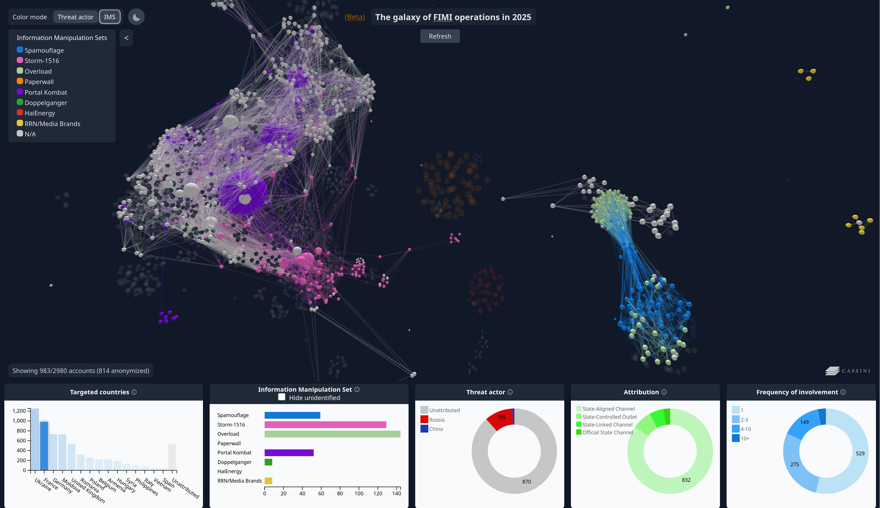
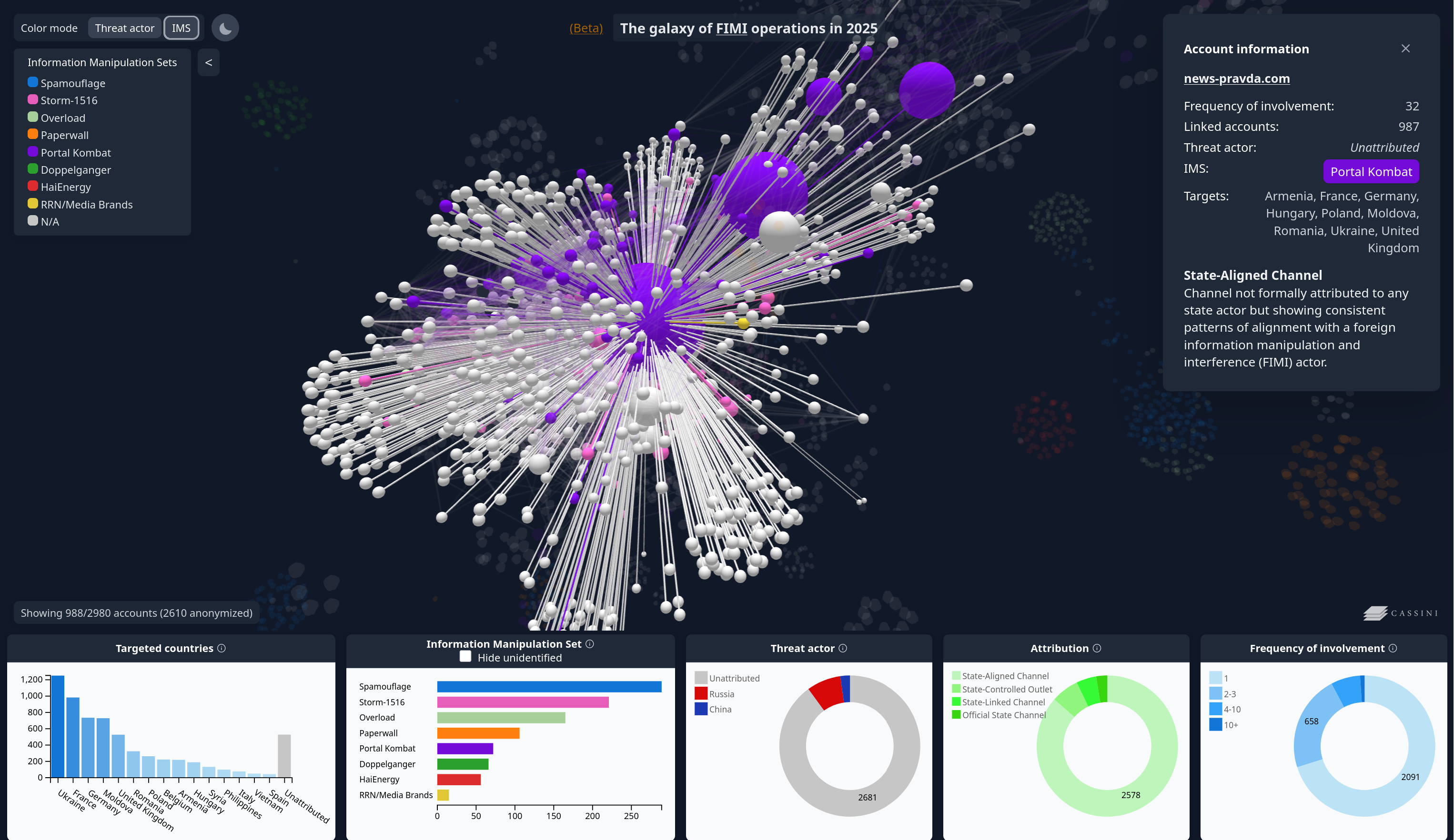
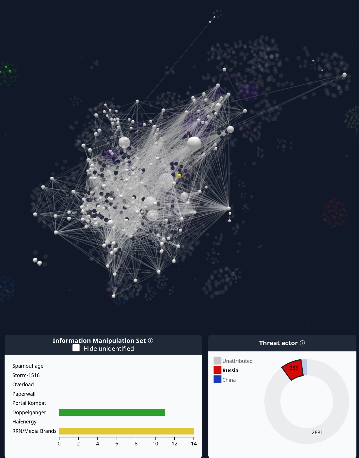
The EEAS sought an interactive graph to visualise, explore and showcase a rich database on FIMI operations. Developing this required overcoming several technical and methodological challenges.

The first challenge concerned the sensitivity of the data. Most of the graph’s nodes had to be anonymised, except for a selection precisely defined by the EEAS. The tool therefore had to balance readability, analytical value and the protection of sensitive information.

The second challenge was the volume and complexity of the dataset. The graph had to include around 3,000 nodes and more than 100,000 links, which represented a major technical challenge in terms of performance, display fluidity and accessibility for public use.

The timeline was also a major constraint. The tool had to be designed, populated, tested and stabilised within a very short timeframe, with data updates continuing until the final days before its public presentation.

Solution deployed

CASSINI developed an interactive visualisation tool built around a 3D graph for exploring relationships between entities, operations, sources and dynamics associated with the FIMI cases documented by the EEAS.

The work covered several complementary areas:

  • data structuring
  • preparation of anonymisation rules
  • integration of the 3D graph
  • optimisation of the display of a large volume of links
  • adaptation of the interface for public use (including the creation of a tutorial)

The objective was to produce an educational and visually polished tool without reducing the complexity of the dataset.

CASSINI’s expertise also helped the EEAS identify the strategic elements to highlight, so that the graph could serve simultaneously as an analytical tool, a demonstration medium and a communication resource.

Strategic impact

The FIMI Explorer was integrated directly into the EEAS’s fourth annual report on FIMI operations targeting the European Union, giving it immediate institutional visibility. The tool was also presented publicly at the EEAS annual conference on FIMI in Brussels.

Beyond this publication, the graph has become a resource that the EEAS can use in its regular presentations on FIMI operations. It makes complex data accessible, visualises interactions between entities and helps users better understand the relational dynamics at work in the documented operations.

The integration of the FIMI Explorer into the EUvsDisinfo website made the tool accessible within the EEAS publication environment, while ensuring the continuous availability of the visualised data for analytical and institutional uses.

This project illustrates CASSINI’s ability to process sensitive and high-volume datasets, transform them into robust interactive interfaces and support their strategic promotion among institutional stakeholders. It also demonstrates the team’s capacity to provide optimal long-term support, with future updates to the tool already planned, both in terms of data and functionalities.

Previous case study

Deployment of a geopolitical observation system across different linguistic and geopolitical spaces
Strategic intelligence
Information Monitoring System
To meet several needs of the Ministry of Armed Forces, CASSINI designed and deployed strategic monitoring systems covering three major linguistic spaces: the Arabic-speaking world, the Russian-speaking space, and the French-speaking regions of West Africa.

Next case study

Risk assessment & geopolitics
Territorial Analysis and Strategic Support in the Construction of the Jerusalem Tramway
As part of its participation in a Franco-Israeli consortium responsible for building a tramway in Jerusalem, Veolia faced international contestation. CASSINI produced a geopolitical analysis and detailed maps to inform the judicial debate.