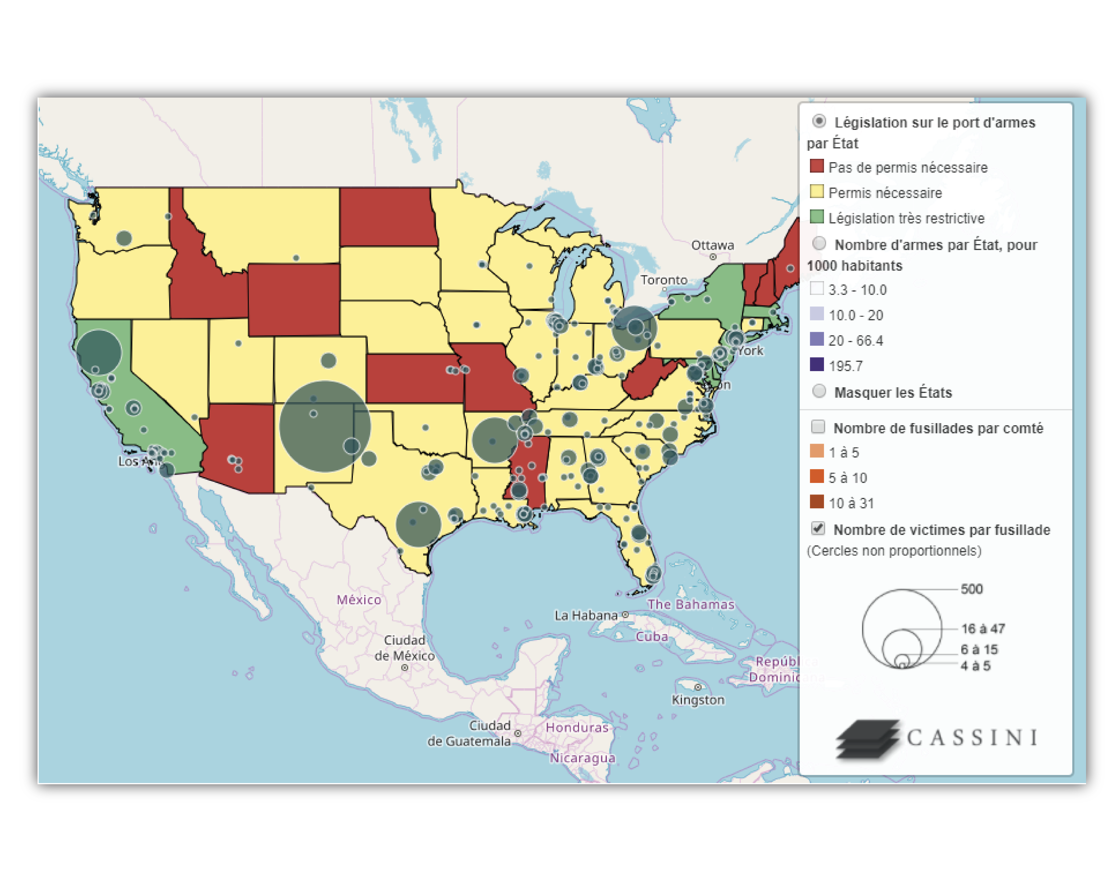
DYNAMIC MAPS
- A progressive reading of the map through a system of checkboxes (CheckBox). This allows the user to make the different layers that are superimposed on the map appear or disappear in order to better understand their correlation.
- The creation of a cartographic scenario to facilitate the understanding of a complex situation. Within a single window, it is possible to switch between many maps that are completed to address a set of themes.
- The enhancement of the information contained in a database through pop-up windows. By clicking or hovering the mouse over a point, a line, or a surface, we can obtain different information about its name, nature, and characteristics.
- The instantaneous change of geographical scale to navigate over the analyzed territories. Sometimes it is necessary to zoom in or zoom out on a map to better understand what is at stake in a study.
Cartographic tools have improved a lot in recent years. It is now possible to create cartographic supports with a huge amount of information and with a greater pedagogical capacity in order to allow users to interact directly with the map. The interactivity of the maps offers numerous potentialities, in particular: